Reimagining Clarington’s Waterfront: A vision for the future
Clarington is developing a bold new vision for its 34 kilometres of Lake Ontario waterfront. Our goal is to create a vibrant, accessible, and sustainable waterfront that serves residents, welcomes visitors, and protects the natural environment—now and for generations to come.
The draft Waterfront Strategy's highlights include:
- More trail connections: A continuous Waterfront Trail linking Courtice, Bowmanville, Newcastle, the Agricultural Heritage Area and Port Granby Nature Reserve.
- Comfort, accessibility and wayfinding features: Shade, seating, lookouts, multi-use trails, washrooms, parking and opportunities for small, seasonal mobile rentals and concessions.
- Shoreline protection: Plans to address erosion, flooding and climate impacts while keeping the waterfront public and accessible.
Five Distinct Experiences:
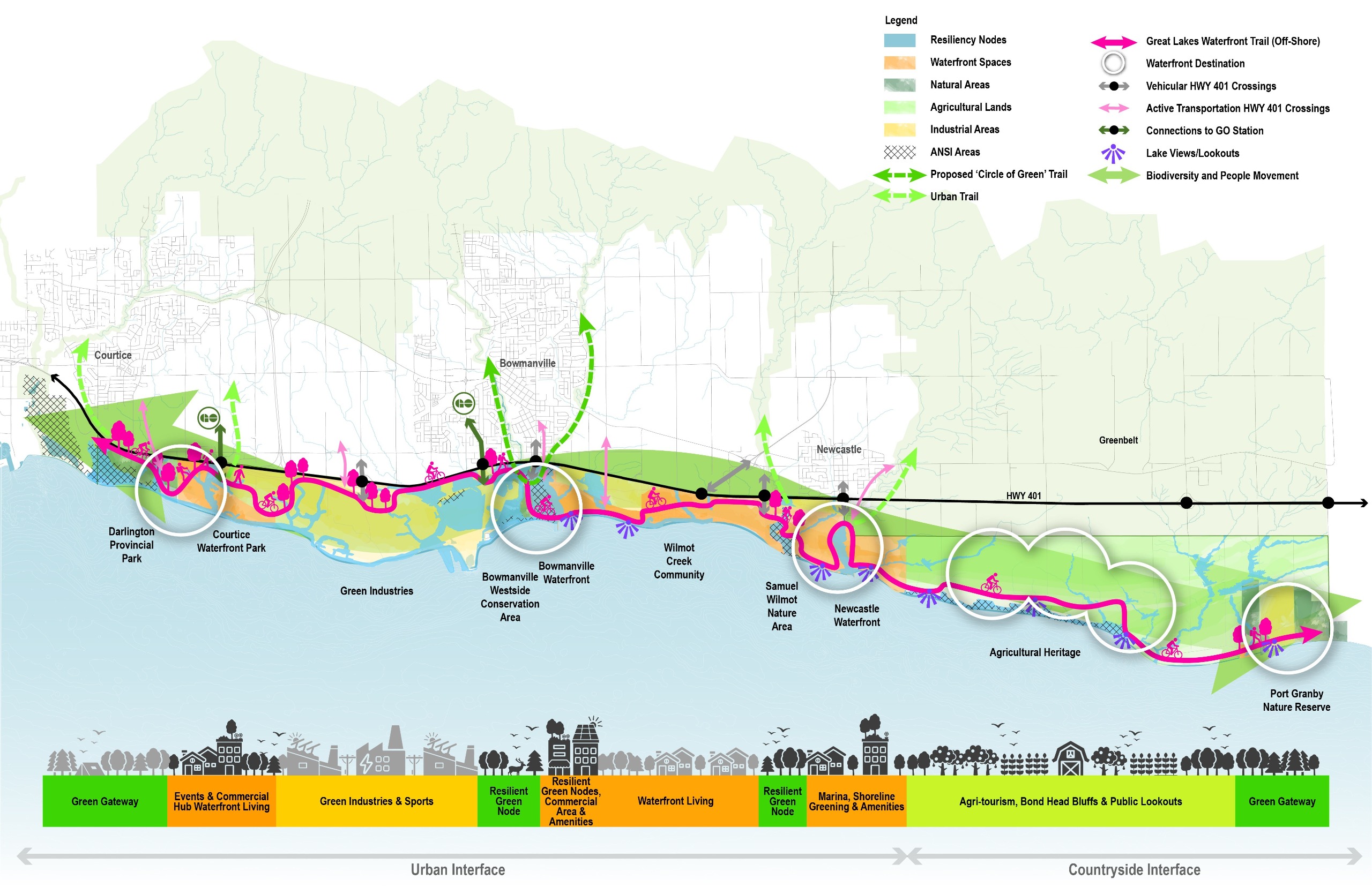
The draft Strategy highlights Five Distinct Experiences across our waterfront, from vibrant urban lakefronts in Courtice, Bowmanville and Newcastle to quieter, nature focused areas at the Agricultural Heritage Area and Port Granby Nature Reserve – all connected by accessible trails and beautiful views.
Clarington Waterfront Strategy Presentation - March 9, 2026, Planning and Development Committee Meeting
One Connected Waterfront
Over the next 30 years, Clarington’s waterfront will flourish as One Connected Waterfront with Five Distinct Experiences—a welcoming, publicly accessible, and environmentally sustainable shoreline that enhances quality of life, supports scalable economic growth and tourism, and delivers social, health, environmental, and community benefits.
In May 2025, the draft Vision and Guiding Principles for the renewed Waterfront Strategy were presented at the Planning and Development Committee. A copy of the materials are available at www.clarington.net/Calendar.
A clear vision is essential, as it sets the long-term direction and unites around a shared purpose. It inspires action, guides priorities and ensures that all decisions contribute to a cohesive, future-focused outcome.
The Overall Draft Vision: Clarington's waterfront is a publicly accessible space that connects our community; protects natural systems, climate resilience and biodiversity; and honours our history and cultural heritage. Our shoreline flourishes with interconnected trails and diverse recreational opportunities while placing environmental stewardship at the forefront. We grow our waterfront sustainably, protecting the important coastal functions and landscapes, while also ensuring public safety and accessibility over time.
To support the implementation of this draft Waterfront Vision, five guiding principles have been developed to establish a framework and set priorities for future decision-making.
- Environmental Stewardship and Climate Resilience: Protect, restore, and enhance the natural environment, including the Lake Ontario shoreline, wetlands, and wildlife habitats, while actively planning for flood and erosion hazards and climate change adaptation and protecting biodiversity.
- Public Access, Connection, and Enjoyment: Ensure equitable, safe, and inclusive access to the waterfront for all residents and visitors, prioritizing public ownership and enjoyment of shoreline lands, recognizing the waterfront as a continuous and integrated corridor that supports ecological connectivity, including wildlife movement and sediment transport along the nearshore, and enhances public trail connections that link communities and natural spaces.
- Cultural Histories and Traditions: Celebrate the layered cultural histories and traditions on the waterfront lands through acts of reconciliation, a culture of inclusiveness and belonging, and through the historic interpretation of public spaces through design and local stories.
- Community-Scaled Economic Viability: Foster a sustainable waterfront economy that supports small-scale, local businesses, creates employment opportunities for the community, and encourages tourism that complements the natural environment and enhances public enjoyment.
- Design Excellence and Community-Centred Planning: Create high-quality and impactful public and private realms through thoughtful, sustainable design that reflects the local character and is guided by transparent and meaningful community engagement.
In July 2025, the community was asked to share their feedback on the draft Vision and Guiding Principles, to help shape the renewed Waterfront Strategy.
- Find out what we heard.
- Read the full staff report.
Extensive public input on Clarington’s waterfront was collected in 2022 and as part of the Parks, Recreation and Culture Master Plan (PRCMP) in 2023. This collective data and community input helped define the draft Vision & Guiding Principles. Here's what we've heard from you so far:
- 85 per cent of PRCMP survey respondents support additional public investment in Clarington’s waterfront
- Prioritize protecting the natural environment and planning sustainably
- Expand trails, improve active transportation links, and enhance wayfinding
- Strong interest in a more vibrant commercial presence and year-round activities such as outdoor skating, cultural events, and watercraft access
- A desire for an accessible, public-oriented waterfront with amenities, events, and attractions
- Broad support for increased public investment in parks, recreation, and cultural facilities
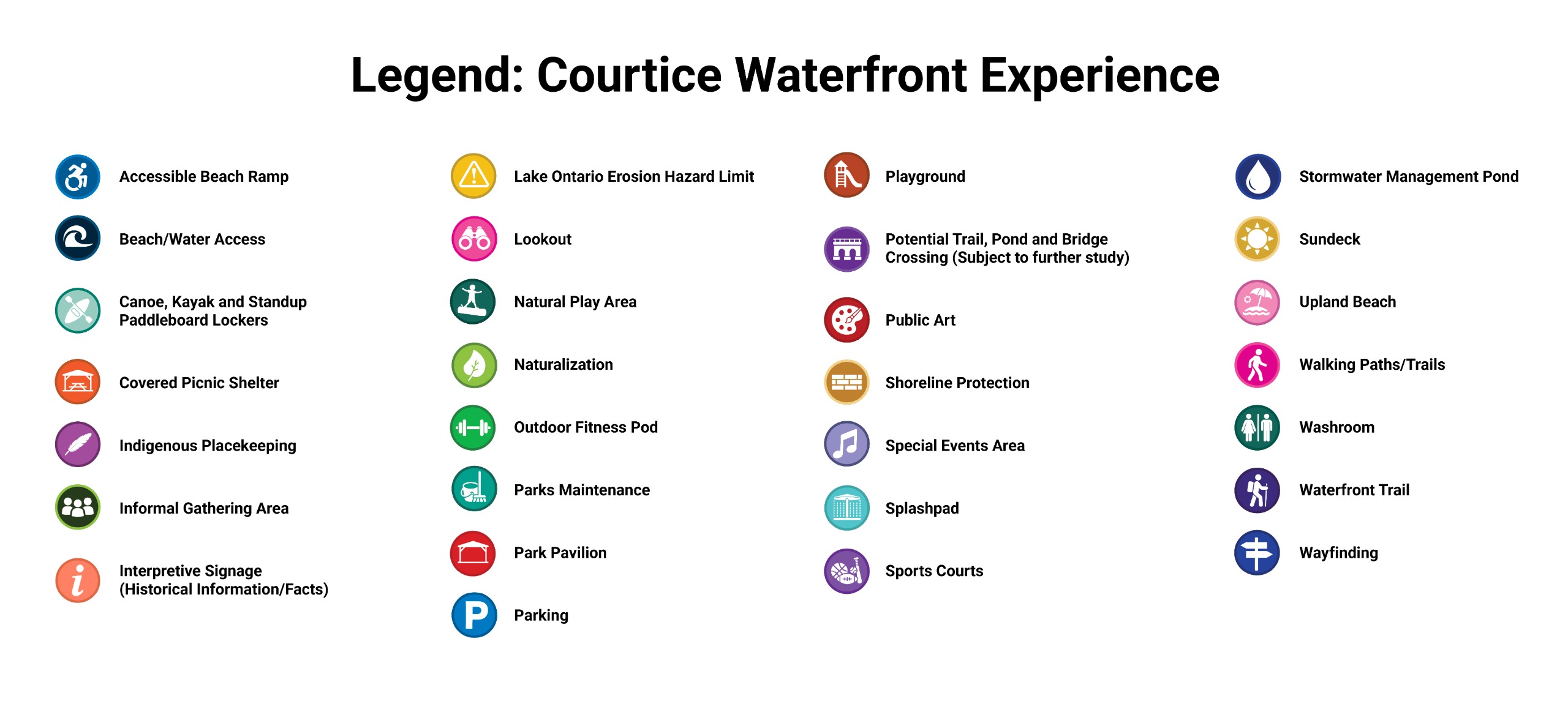
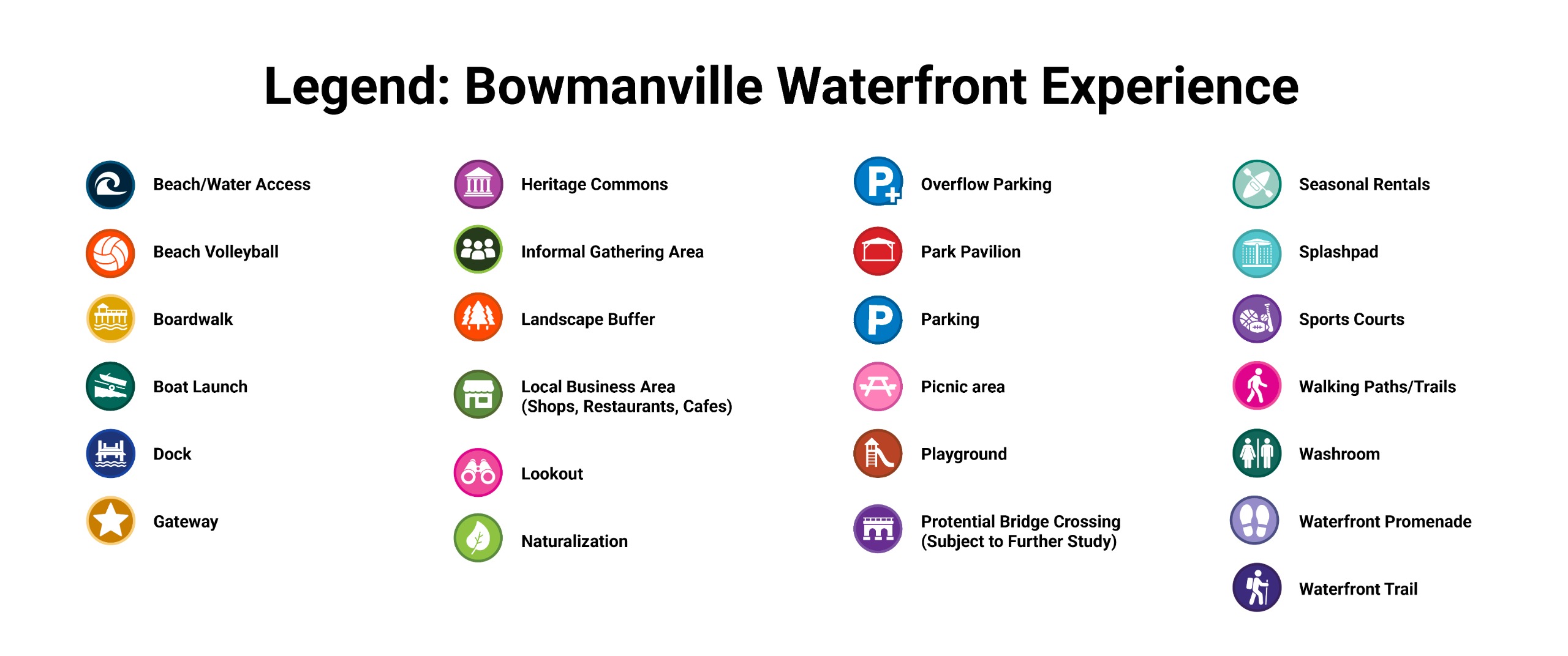
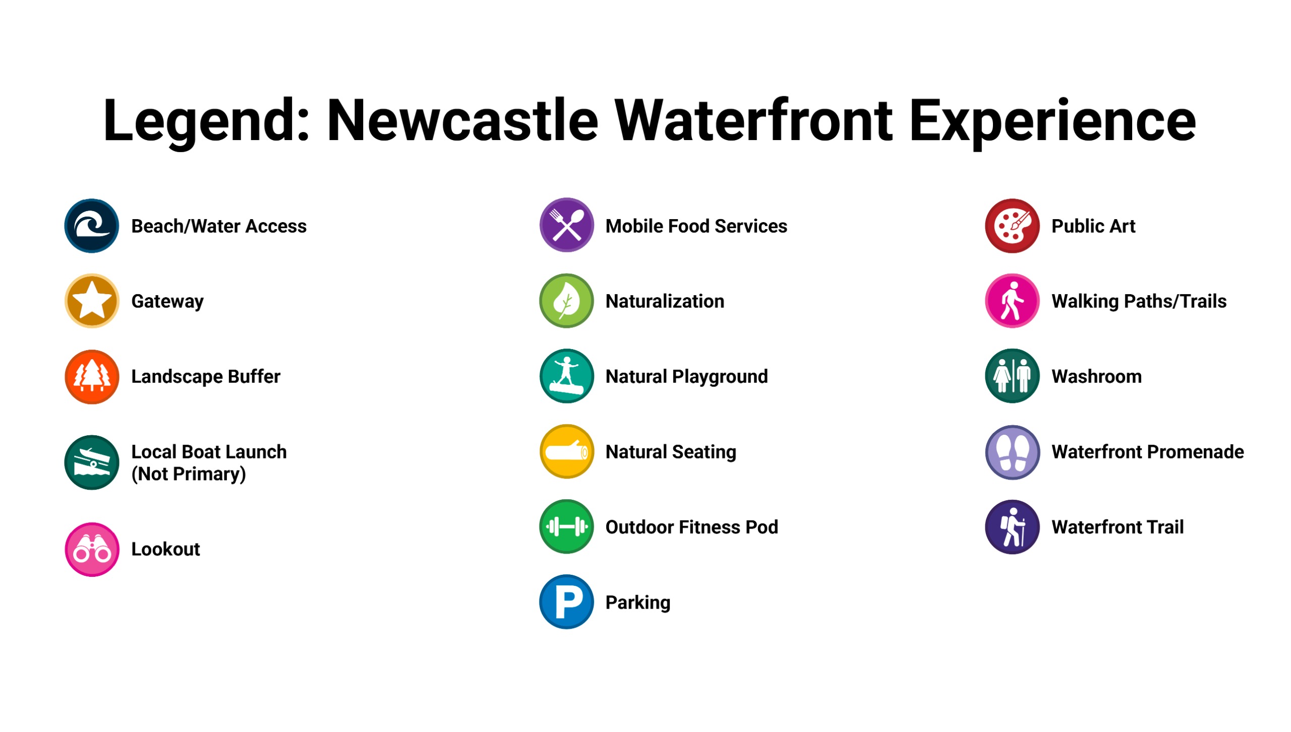
Explore the draft concept maps below for the Courtice Waterfront Experience, Bowmanville Waterfront Experience and Newcastle Waterfront Experience. Drop a pin to leave comments directly on the map or weigh in on other ideas by using the thumbs up or thumbs down button.
Please note: Information about the Agricultural Heritage Area and Port Granby Nature Reserve is available through the tabs below; however, feedback for these areas can only be provided through the online survey above.
Courtice Waterfront Experience
Bowmanville Waterfront Experience
Newcastle Waterfront Experience
Agricultural Heritage Experience
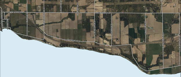
East of Newcastle, the draft concept for the Agricultural Heritage Experience prioritizes passive, low‑impact access. Rest stops set back from the eroding bluff edge with natural seating will offer scenic lookouts, along with on-road trail improvements for safer cycling and walking.
There is potential for agri-tourism experiences in this area, including farm stalls and pop-up markets along main active transportation routes. There will be no new structural investment within erosion‑hazard limits, maintaining a light‑touch approach that preserves rural character and shoreline safety.
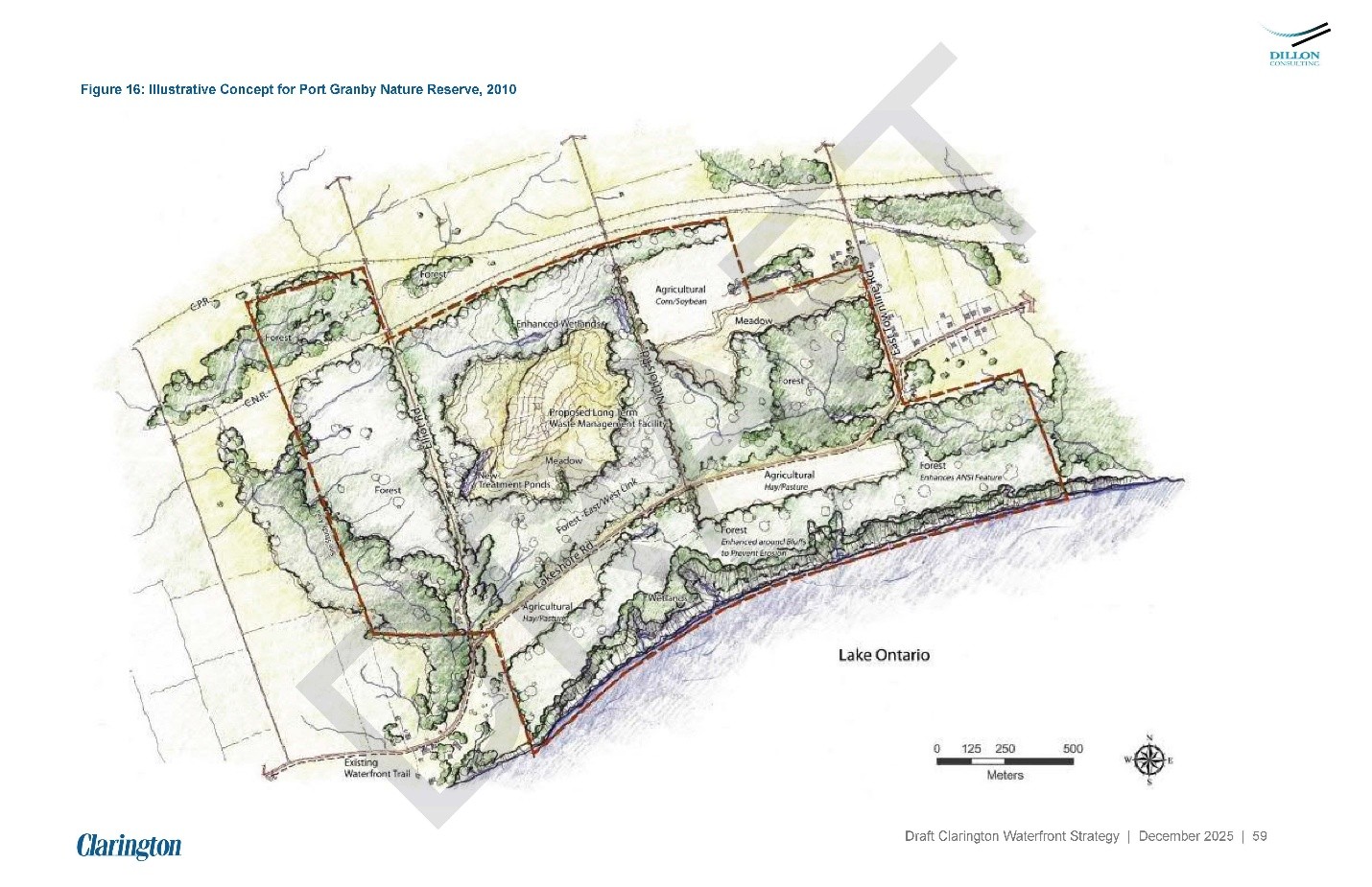
Port Granby Nature Reserve Experience
The draft concept for the Port Granby Nature Reserve Experience will follow the previously approved Master Plan (pending federal land transfer) and focus on ecological restoration and low‑impact public access. Visitors could experience:
- Accessible primary trails and more rugged secondary trails
- Set‑back lookouts with lake views
- Interpretive signage and designated daytime picnic areas
- A modest gateway and parking area designed using low‑impact development (LID) features.
To protect sensitive habitats and hazard areas, there will be no direct access to the lake.
Resources
1992 Waterfront Study – Recommended Land Use Strategy (available on request)
- Clarington Draft Waterfront Strategy Presentation - March 9, 2026
- Clarington Waterfront: Draft Vision and Guiding Principles Presentation
- Video: An Introduction to Renewing Clarington’s Waterfront vision


